A big city, often known as a metropolis, is a substantial economic, political, and cultural center for a nation or area and an essential hub for regional or global connections, trade, and communications.
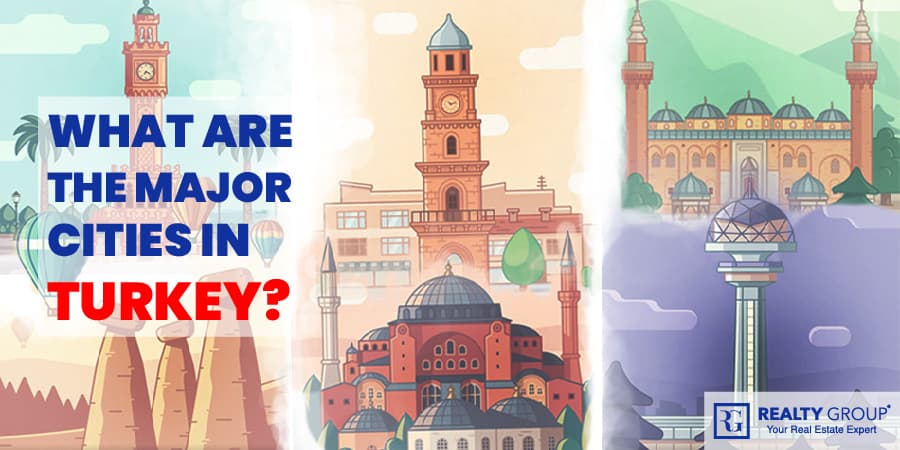
Turkey consists of 30 major cities and metropolitans in total, all listed below.
1. Adana – Adana Metropolitan Municipality
Adana lies in Turkey’s southeastern Mediterranean region. The metropolis of 14,000 square kilometers is situated on the Seyhan and Ceyhan rivers. With a population of 2.2 million people, it is Turkey’s sixth-biggest city.
The city is located at the foot of the Taurus Mountains and is the physical and cultural heart of Cukurova. Adana has a total shoreline of 160 kilometers in the Mediterranean Sea’s south, and the Mediterranean climate is evident in this location.
Adana was one of Turkey’s earliest industrialized areas. The product richness and accessibility brought the industrial field to raw resources in Cukurova, one of the world’s most significant plains. Cotton production started to expand quickly in the rich soil of Adana from the second part of the nineteenth century. As a result, ginning and textile industries were established, which were among the earliest in Turkey.
Adana has always been a popular tourist destination due to its lush plains and commerce routes that run via its mighty rivers and dams. However, according to the National Regional Development Strategy developed by Turkey’s Ministry of Development, only Cukurova was identified as a prospective metropolitan region in Turkey, following Istanbul, Ankara, and Izmir.
2. Ankara – Ankara Metropolitan Municipality
Ankara, formerly known as Angora, is Turkey’s capital and is in the country’s northwest. It lies approximately 200 kilometers south of the Black Sea, near the Hatip, Su, and Cubek rivers. Ankara has a population of 5.663 million people in 2020.
Ankara, Turkey’s capital city, is the country’s second-biggest and most important economic hub on a national and worldwide scale. Ankara’s solid and stable economy has profited from its geographical location, modern infrastructure, and increasingly youthful population with highly qualified labor.
In addition, the proximity of markets in the EU, Middle East, North Africa, Asia, and Russia is a driving force for foreign capital and multinational enterprises. Furthermore, Ankara was chosen as the location for almost 2,300 such businesses.
Turkish history in Ankara in the Byzantine era, both the Persians and the Arabs assaulted Ankara. After the Turks captured Ankara in 1073, the Crusaders Raymond IV of Toulouse pushed them out in 1101. But despite the Byzantines’ efforts, the city remained a source of strife between the Seljuqs and their Turkish border lord adversaries.
Following the Seljuq conquest in 1143, the rulers of the Seljuq dynasty fought for control of the city. The establishment of the Seljuq Empire caused Ankara to fall. The second Sultan of the Ottoman dynasty, Orhan (Orkhan), gained control of the city in 1354 and, in 1360, it became a part of the Ottoman lands.
Timur’s invasion of Anatolia surrounded Ankara (Tamerlane). After being reclaimed by Ottoman Empire in 1403, the city gained new importance as a trade and urban hub due to its caravan route to the East.
3. Antalya – Antalya Metropolitan Municipality
With over one million people, Antalya, situated on Anatolia’s southwest coast and bordered by the Taurus Mountains, is the biggest Turkish city on the Mediterranean coast outside of the Aegean area. Antalya’s population is expected to be 1,254,000 in 2020. Antalya ranks eighth in terms of population and national income.
Antalya is Turkey’s number one metropolitan tourism city. The city’s economy is based on tourism. An estimated 9-10 million tourists visit Antalya each year, amounting to 35% of all visitors to Turkey.
Antalya is considered the tourist industry’s backbone in Turkey. Antalya welcomes tourists all year, and a growing number of hotels are open all year. The tourist industry’s rapid diversification aids this tendency into hunting, winter sports, hiking, health, and convention groups. At the same time, specialization in these tourist sub-sectors is growing.
Antalya has been continually inhabited since the second century BC, when Attalus II, a Pergamon prince, founded it. The Romans, Byzantines, and Seljuks all controlled the town before the Ottomans. The majestic fluted minaret of the Yivli Minaret Mosque, erected in the 13th century by Seljuk king Alaeddin Keykubad I, is Antalya’s icon.
The Karatay Medrese in Kaleici shows the best Seljuk stone sculptures. The city’s two most important Ottoman mosques are Murat Pasa Mosque and Tekeli Mehmet Pasa Mosque. The late-19th-century Iskele Mosque is built on four pillars above a natural spring near the harbor.
The Hidirlik Kulesi was probably built as a lighthouse in the 2nd century. The Kesik Minaret Mosque, now a church, has been restored by the Romans, Byzantines, Seljuks, and Ottomans. In 130 AD, a brilliantly decorated three-arched gate was built inside the city defenses to honor Emperor Hadrian’s visit.
4. Aydin – Aydin Metropolitan Municipality
Aydin Province is a southern Turkish province in the Aegean Region. The population of Aydin in 2021 is 186,750 people. Aydin is famous for its cotton and grain. It has olive trees. Many small firms export olive oil to foreign countries.
In recent decades, Aydin has established a more diverse economy based on services, moving away from its original role as an agricultural center. In 1992, Adnan Menderes University, named after Efeler’s favorite son and former Turkish Prime Minister Aydin Adnan Menderes, opened.
The city’s location, an hour from the coast, dictates its economic speed. Aydin residents own vacation houses and invest in tourist attractions including Kusadasi, Guzelcamli, and Didim. Aydin Province’s dominance in manufacturing a variety of agricultural items, particularly figs, still defines the city. Aydin controls and manages most of this trade.
The ancient Thracians built Aydin, which was formerly known as Tralles. The city was constructed and rebuilt by Spartans, Phrygians, Ionians, Lydians, Persians, and Ancient Romans in an earthquake-prone region.
The Seljuk Turks gained control of the area in 1186, followed by the Aydinid Anatolian beylik. The town was known as Aydin Guzelhisar, and the Ottoman Empire conquered it in 1426.
5. Balikesir – Balikesir Metropolitan Municipality
Balikesir is a city in Turkey’s Marmara region with 1.229 million people (2019). It was the capital of Karasi from 1341 to 1922.
Agriculture and industry support the city’s economy. Balikesir is important for farming as outer-city dairy farms abound. The city is also an agricultural hub. Tobacco and bean plantations are surrounded by wheat, sunflower, and sugar beet fields. Crops like melon and grapes are old Balikesir has the 12th largest economy in Turkey. The Anatolian Tigers. Other notable exports are olive products. It is also a popular location for exploring the beautiful surrounding countryside.
Balikesir was named after the castle ruins by Turkmen immigrants from the Middle East. They annexed Balikesir in 1345. An earthquake of 1898 devasted much of Only 51 structures survived the 1898 quake. It was conquered by the Greeks on June 30, 1920, but recaptured by the Turks on September 6, 1922. Western Anatolia’s Greek fighting bases were in Balikesir during the Turkish War of Independence.
6. Bursa – Bursa Metropolitan Municipality
Bursa is the administrative capital of Bursa Province in northern Turkey. Bursa, Turkey’s fourth-most populous city and the second-most populous in the Marmara Region, is an industrial center. For example, Bursa is home to most of Turkey’s automobile manufacturing. Bursa will have a population of 1,986,000 people in 2020.
Turkish automakers are based in Bursa, Turkey’s largest automotive hub. Automakers including Fiat, Renault, and Karsan have long had plants here, as have component suppliers like Bosch, Mako, Valeo, Johnson Controls, and Delphi. Clothing and nourishment are also crucial. Coca-Cola, Pepsi Cola, and other brands are sold in the city’s industrial zones and food markets. Bursa is a major center for the automobile industry, but it also produces dairy products and processed foods and beverages.
During the Byzantine and Ottoman eras, when the Silk Road was at its peak, Bursa’s major claim to fame was silk. Bursa’s textile and commerce center is also the city’s largest textile production cluster. Bursa is also known for its fertile land and agriculture. Still, heavy development has limited the area’s farming.
Bursa is a popular vacation spot. Mount Uludag is home to one of Turkey’s most famous ski resorts. It is thought that therapeutic bathing was popular in Roman times. The Uludag University campus also has a thermal water-based rehabilitation clinic.
Bursa became the early Ottoman Empire’s first major capital city in 1326. The 13th-century catastrophe accelerated urbanization. Adrianople (Edirne) became the Ottoman capital of East Thrace in 1363, though Bursa remained a spiritual and economic hub. Sultan Bayezid I built the Bayezid Kulliyesi (Bayezid I theological complex) at Bursa between 1390 and 1395, and the Ulu Cami between 1396 and 1400.
Throughout the Ottoman era, Bursa was the main source of royal silk. Until the 17th century, the city was the only source of silk for the Ottoman palaces, importing it from Iran and China. As a result, Armenian merchants in the region’s bustling trading center prospered financially.
Bursa became an industrial hub in 1923, the year the Turkish Republic was founded. Bursa grew rapidly, becoming Turkey’s fourth-largest city.
7. Denizli – Denizli Metropolitan Municipality
Denizli is an industrial city in southwestern Turkey. It is located at the eastern end of the alluvial valley produced by the river Buyuk Menderes, where the plain reaches a height of around 350 meters (1,148 ft). Denizli is situated in the Aegean Region of Turkey. The population of Denizli in 2020 is 644,782.
Denizli is one of Turkey’s wealthiest areas in terms of visible marble and travertine deposits. Denizli has a capacity of 600.000 m3 for marble manufacturing. Denizli exported 315 million dollars in marble goods in 2014. Because of its favorable climate and terrain, it is ideal for viticulture and grape cultivation.
The city is well-known for a variety of other industries, including copper wire and cable, weaving, textiles, and garments, leather preparation, greenhouse, and organic agriculture, travertine and marble, viticulture and winemaking, tourism for religious and cultural reasons, and thermal and wellness tourism.
Denizli was an important Greek and Roman town named Attouda. It thrived in Byzantine cities (Hierapolis and Laodicea on the Lycus). The Turks took it. Laodiceans were transferred here during the Seljuk era.
Ibn Battuta visited the city and noted its “magnificent gardens, perennial streams, and running springs, as well as its seven mosques for Friday prayers.” They are mostly Greek women, as many Greeks are Muslim and pay jizyah and other taxes to the Sultan.”
“The city is termed by Turks as (Denizli) (which means numerous water sources like the sea in Turkish) as there are various rivers and lakes around it,” noted Turkish explorer Evliya Celebi in the 17th century.
8. Diyarbakir – Diyarbakir Metropolitan Municipality
Diyarbakir, sometimes spelled Diyarbekir, is a city in southeastern Turkey that was previously known as Amida. It is located on the Tigris River’s right bank. The name derives from the Arabic term for “district (diyar) of the Bakr people,” an Arab clan that captured the city in the 7th century CE. The current form of -bakir (Turkish for “copper”) is believed to allude to the abundance of copper in the area. It has a population of 1.783 million people in 2020.
Diyarbakir used to grow wheat and sesame. They’d store the grain in straw and licorice tree branches. This technology can preserve grain for up to ten years. Early twentieth-century Diyarbakir exported almonds and apricots to Europe. Diyarbakir also raised Angora goats and sold wool and mohair. Egypt, Istanbul, and Syria merchants came to buy goats and lambs. Honey was also produced, but it was largely consumed locally. The region has seen sericulture.
Before WWI, Diyarbakir had six copper mines. Three were operating, two owned by Turkish citizens and one by the Turkish state. Tenorite was the most common copper mine. Metals, such as iron, gypsum, and quartz were manufactured for local usage. The city has two airports and a railway station. Elazig-Diyarbakir railway opened in 1935.
Humans have resided in Diyarbakir since Stone Age. It was Mitanni, a Hurrian monarchy, that established a prominent civilization in Diyarbakir. It was ruled by the Arameans, Assyrians, Urartu, Armenians, Achaemenid Persians, Medes, Seleucids, and Parthians.
The Roman Republic dubbed the city “Amida” in 66 BC. Persian Shapur II besieged Amida for 73 days in 359. According to Hierocles’ Synecdemus, Diyarbakir was known as Amida. It was the diocese’s episcopal see.
Amida had an amphitheater, thermae (public baths), warehouses, a tetra pylon monument, and Roman aqueducts. The Sasanian Empire under Shapur II (r. 309–379) successfully sieged Amida, according to Roman historian Ammianus Marcellinus. Refugees from Nisibis later augmented Amida (Nusaybin).
9. Erzurum – Erzurum Metropolitan Municipality
Erzurum is a city in the Turkish province of eastern Anatolia. It is the biggest city in Erzurum Province and its capital. It is located at a height of 1,900 meters above sea level. Erzurum’s population was 431,000 in 2020.
The city’s prosperity and economic activities have been fueled by Ataturk University. It was started in 1950 and presently has around 45,000 students. Tourism is also important to the province. Thanks to Palandoken Mountain, the city is a popular winter sports destination in Turkey. For its small-scale production of Oltu stone items, Erzurum is well-known. Erzurum is currently the terminal of the Baku-Tbilisi-Erzurum (BTE) pipeline.
During the Urartian era, Diauehi undoubtedly ruled Erzurum’s surroundings. In Armenia, Erzurum became Karin. During the Artaxiad and Arsacid dynasties, Karin was the capital of the province of Bardzr Hayk’ (Upper Armenia).
The city was fortified and named Theodosiopolis after Emperor Theodosius I after the division of Armenia between the Eastern Roman Empire and Sassanid Persia in 387 AD. Theodosiopolis, the empire’s principal military bulwark on the empire’s eastern frontier, was battled over in Byzantine-Persian wars. Both Anastasius I and Justinian I rebuilt and fortified the city.
10. Eskisehir – Eskisehir Metropolitan Municipality
Eskisehir is the capital of the Eskisehir Province in northern Turkey. It was known as Dorylaeum during the Byzantine era and the population in (2020) is 783,669.
Some of the items produced in Eskisehir are rail locomotives, passenger and commercial vehicles, fighter jet engines, agricultural machinery, textiles, brick, cement, chemicals, meerschaum, and refined sugar.
Eti, one of Turkey’s major food companies, is headquartered in Eskisehir. Arcelik, a prominent Turkish producer of home appliances and consumer electronics, operates a manufacturing unit in Eskisehir.
Eskisehir was the first stage of Turkey’s high-speed rail line from Ankara. Because of the shorter trip time, this service increased travel and trade between Eskisehir and Ankara. GKN, a prominent global automotive provider of powertrain systems for passenger and commercial vehicles, operates a factory in Eskisehir.
Eskisehir translates to “Old City” in Turkish. The Phrygians established the city at least 1000 BC. However, it is thought to be older than 4000 years. The present city is roughly a mile from Dorylaeum, a Phrygian ancient town.
The city’s archaeological museum still has many Phrygian antiquities and sculptures. There is also a museum dedicated to meerschaum stone, which is still used to produce high-quality meerschaum pipes. The city relocated about ten kilometers northeast, from Karacahisar to Sehirhoyuk, in the fourth century AD. Many ancient geographers regarded the city as one of Anatolia’s most beautiful.
11. Gaziantep – Gaziantep Metropolitan Municipality
In the westernmost section of Turkey’s Southeastern Anatolia Region, Gaziantep is the capital of Gaziantep Province, near Aleppo, Syria. It is most likely located near ancient Zeugma and on the site of ancient Antiochia and Taurum. The city is divided into three urban districts: Oguzeli, Sahinbey, and Sehitkamil. It is Turkey’s sixth-most populated city. In (2020), the population is 1,704,000 people.
For both exports and imports, Gaziantep leads Turkey’s organized industrial region. The city is also the hub of the green olive oil-based Nizip Soap industry. The most famous covered markets in Gaziantep were Zincirli, Hüseyin Pasha, and Kemikli.
Tourism is booming in Gaziantep. The construction surrounding the castle’s foundation enhances the court and the nearby copper workshops. New restaurants and tourist attractions are opening nearby. Tourists are still rare in Gaziantep compared to other parts of Turkey, but they are warmly welcomed. Many ESL students wish to be tour guides.
Gaziantep is a world leader in machined carpets. In 2006, it exported machine-made carpets worth $700 million. Around 100 carpet factories operate in the Gaziantep Organized Industrial Zone.
Gaziantep is surrounded by huge olive groves, vineyards, and pistachio farms. In 2007, Gaziantep produced 60,000 metric tons (59,000 long tons; 66,000 short tons) of pistachios. It’s called Antep fistigi, which means “Antep nut” in Turkish.
It is believed that the Hellenistic city of Antiochia and Taurum was in Gaziantep. In the 6th century, Byzantines reconstructed the Gaziantep Fortress and the Ravanda Citadel, both in the city center.
Although it was only under the sovereignty of the Armenian Kingdom of Cilicia from 1155–1157 and 1204–1206, Gaziantep was home to a sizable Armenian community for the majority of the last two millennia.
The Ottoman Empire conquered Gaziantep in 1516. Aintab was a sanjak in the Ottoman era, based first in the Dulkadir Eyalet (1516–1818) and subsequently in the Aleppo vilayet (1908–1918). In the Aleppo vilayet (1818–1908), it was also a Kaza.
12. Hatay – Hatay Metropolitan Municipality
Hatay Province in Turkey’s southernmost province is nearly completely located outside of Anatolia, along the eastern shore of the Levantine Sea. The province is bounded to the south and east by Syria and the north by the Turkish provinces of Adana and Osmaniye. It is a portion of Cukurova, a vast fertile plain in the cultural area of Cilicia, with Antakya as its administrative seat. the population in (2019) is 1,628,894.
Hatay is a major logistical hub and a Silk Road economic hub for the Mediterranean. Most of its economy is centered on trade and agriculture. The purpose was to create the Hassa- Dortyol Amano mountain tunnel and nine thousand hectares of Hassa Organized Industry projects to support the logistic hub. The region’s steel industry has increased in the last 30 years. The Iskenderun Iron and Steel Factory’s flat plate production enhanced its importance in the area.
Hatay is rapidly expanding cultural, religious, and culinary tourism. The cultural and tourist infrastructure contributes significantly to the socioeconomic structure. Product diversification, early harvesting, multi-crop farming, and Skenderun’s port add to the city’s importance. This is due to Hatay’s agricultural regions, soil structure, and climate. The city’s 42.395 agricultural farms produce almost every form of crop, including livestock.
Agriculture employed 61.62 percent of the working population (518.808) in 2000, services 30.2%, and manufacturing 8.15%. The services industry’s workforce is heavily reliant on wholesale and retail trade (22.17%).
In Hatay, where population development was tracked for three decades, agriculture boomed from 1940 to 1970, industry from 1970 to 2000, and services from 2000 to 2010. Famous archaeological sites in the province include Alalakh, Tayinat, Judaidah, and Antioch.
Hatay was first settled about 3000 B.C. and was afterward ruled by the Akkadian Empire, then the Amorite Kingdom of Yamhad. Later, it became a part of the Kingdom of Mitanni, and the region was governed by a series of Hittites and Neo-Hittites, who gave the current province of Hatay its name.
13. Istanbul – Istanbul Metropolitan Municipality
Istanbul is Turkey’s most significant metropolis and the country’s economic, cultural, and historic center. The city spans the Bosporus, consisting of Europe and Asia, continents with over 15 million people, accounting for 19% of Turkey’s total population. Istanbul is Europe’s most populated metropolis and the world’s fifteenth-largest city. the people in (2020) is 15.46 million.
Istanbul is the top tourist destination in Turkey with an average of 5 million tourists visiting the major city. It is considered to be the cultural, historical, economical, and financial center of the country.
Byzas was the city’s first inhabitants, arriving around 2500 BC, and settled on the Asian side. A colony named Byzantium was established by Megara king Byzas in the 7th century BC.” In the 6th century BC, Persia controlled the city. A.D. 400, Alexander the Great conquered it, and it fell silent until the 2nd century BC.
Septimus Severus, the Roman Emperor, conquered it in 193. Emperor Constantine the Great renamed it Constantinople and designated it the capital of the Roman Empire in the 4th century. That was the start of the Eastern Roman Empire, later known as the Byzantine Empire.
The city was built on seven hills like Rome. Ancient world riches were brought to Byzantine emperors in the 4th and 6th centuries when the city had over 500,000 inhabitants. In 532, under Justinian I, riots ravaged the city. But it was repaired, and magnificent Byzantine structures like Hagia Sophia remain.
The Arabs assaulted Istanbul in the 7th and 8th centuries, and the Barbarians in the 9th and 10th centuries, but the Fourth Crusade occupied it between 1204 and 1261, destroying and plundering all the riches.
Sultan Mehmet II’s Ottoman Turks took Constantinople in 1453. Islambol, the Ottoman capital, was renamed. During the 15th and 16th centuries, Sultans built numerous mosques and public buildings, boosting the population to above 500,000. Early 1500s Istanbul was a major cultural, political, and commercial hub.
Ottoman rule lasted until the Allies conquered Istanbul in WWI. After decades of resistance led by Ataturk against the occupying army, the Turkish Republic was founded in 1923, with Ankara as its capital.
14. Izmir – Izmir Metropolitan Municipality
Izmir is a metropolitan city in the western extremity of Anatolia. Following Istanbul and Ankara, Izmir is Turkey’s third most populated city with a population of 4,367,000 people.
Even though the first civilizations in Izmir existed before 3000 BC, recent digs have found artifacts from only 3000 BC. These investigations revealed that the early inhabitants of Izmir erected their homes on the mound’s highest elevation, on rocks 3 to 5 meters above sea level.
First Bronze Age village. Troy’s cultures and art are mirrored through pottery (3000-2500 BC). Middle Bronze Age habitation layer The stoneware objects found here are similar to Troy II (2500–2000 BC). The third habitation level is Hittite (1800–1050 BC).
However, with the destruction of Troy VII and the Hittite capital Hattusa by Balkan tribes about 1200 BC, Central and Western Anatolia entered a new dark period, the Iron Age. The Iron Age lasted in Anatolia until written in Phrygia in 730 BC and in Western Anatolia about 650 BC.
15. Kahramanmaras – Kahramanmaras Metropolitan Municipality
Situated in Turkey’s Mediterranean region, the administrative capital of Kahramanmaras Province is Kahramanmaras, with a population of 1,168,163 in 2020.
Kahramanmaras was called Germania, in time the Roman and Byzantine empires. According to Cumhuriyet’s report from 2010, the earliest remains of Germanicia have already been discovered in the city’s Dulkadirogulları neighborhoods.
Germania was seized from the Byzantines in 645 by Muslim Arabs, who renamed the city Marash. Mor Dionysius Bar Salibi (died 1171) was the bishop of Marash, an important Syriac Orthodox diocese.
Marash belonged to the fortified Arab-Byzantine border zone (Thughur) for the following three centuries and was used as a base for Arab raids into Byzantine-held Asia Minor. Several times during the Arab-Byzantine Wars, it was destroyed.
After the Armistice of Mudros, British troops controlled Marash from 22 February to 30 October 1919, followed by French troops. The Turkish National Movement took it after the Marash Battle on February 13, 1920.
The Turkish government added “Kahraman” to Marash’s name in 1973 to honor the resistance against French occupation after WWI. “Hero” in Turkish. A massacre of communist Alevis took place in December 1978.
16. Kayseri – Kayseri Metropolitan Municipality
Kayseri is a major industrialized city in Turkey’s Central Anatolia region. It is the administrative center of Kayseri Province. Kayseri is essentially divided into five metropolitan districts, as specified by the boundaries of the Kayseri Metropolitan Municipality; the two core districts of Kocasinan and Melikgazi, Hacilar, Incesu, and Talas. The city’s e population is 973,506 as of 2020.
In the 1920s and 1930s, Kayseri got significant governmental investments. After the Republican Era, Sumer Textile and Kayseri Tayyare Fabrikasi (airplane factory) were built here with the help of German and Russian experts. In the 1940s, the latter produced the first airplane labeled “made in Turkey.” The city suffered from a decline in public investment after the 1950s.
However, it was during the same years that Kayseri tradesmen and merchants evolved into national capitalists. The city’s development rate was so rapid that it applied to the Guinness Book of World Records in 2004 for the newest manufacturing industries established in a single day: 139 factories. Kayseri has also developed as one of Turkey’s most successful furniture-making centers, with over a billion dollars in export earnings in 2007.
In ancient history, the city was the home of Cappadocia’s rulers. During the nearly 200 years of Achaemenid Persian dominance, it was at the crossroads of trade routes from Sinope to the Euphrates and the Persian Royal Road, which stretched from Sardis to Susa. A comparable road from Ephesus to the East passed through the city during Roman times.
From Perdikkas, one of Alexander’s old generals, the city became the capital of a transitory Satrapy under another one of Alexander’s senior generals, Eumenes of Cardia. Finally, after the battle of Ipsus, a Seleucid city became the capital of a Greater Cappadocian kingdom under Ariarathes III of Cappadocia in about 250 B.C.
The city was officially controlled by the Romans in 17 AD. However, the Sassanid monarch Shapur I destroyed Caesarea after defeating Emperor Valerian I in 260 AD. It was believed that about 40,000 people lived there at the time.
The Grand Bazaar was built in the late 1800s, although the neighboring caravanserai originates from about 1500. In the 1970s, the town’s older districts (packed with magnificent mansion-houses) were subjected to widespread demolitions. The Grand National Assembly’s new home, the Kayseri Lyceum, was built in Ankara, which was the capital of the Turkish National Movement’s base. The city is now well-known for its carpet merchants.
17. Kocaeli – Kocaeli Metropolitan Municipality
As one of only three Turkish provinces with no capital-to-province name match, Kocaeli Province is in Turkey and is also known as Kocaeli. The region succeeded the Ottoman-era Sanjak of Kocaeli. The province’s two biggest cities are Izmit and Gebze.
Kocaeli is bounded by Istanbul province and the Marmara Sea on the west, the Black Sea on the north, Sakarya province on the east, Bursa province on the south, and Yalova province on the southwest. The population was 1,953,035 in 2019
Industrial businesses are concentrated in the districts of Gebze, Izmit, and Korfez. Istanbul is home to 26% of Turkey’s top 100 industrial companies, which manufacture numerous goods. There were countless manufacturing branches in Kocaeli, but the chemical sector was the most important, accounting for 28% of all output. Metalware, automobile, stone, and soil-based industries all grew in importance in Kocaeli.
Kocaeli is home to not only local but also economically significant foreign-owned industrial companies. On the other hand, the Kocaeli industry consumes roughly 10% of all energy used in the nation.
Kocaeli has also ranked top in Turkey regarding yearly national income per capita during the past ten years. Kocaeli, an industrial city, is an area where the industrial sector accounts for about 70% of GDP.
Kocaeli was formerly part of the kingdom of Bithynia (3rd century BCE), and in 183 BCE, the Carthaginian commander Hannibal was buried there (near modern Gebze).
The Ottoman Turks conquered the region from the Byzantine Empire in the 14th century. Izmit is the province’s primary outlet for agricultural (mainly sugar beets and tobacco), forest, and industrial (primarily cement, paper goods, textiles, and petroleum) products. Its area is 1,400 square miles (3,626 square km).
18. Konya – Konya Metropolitan Municipality
Konya is a large city in south-central Turkey, on the southwestern border of the Central Anatolian Plateau. It is Turkey’s seventh-most populated city, with a metropolitan population of over 2.2 million people.
The city is one of the Anatolian Tigers. There are many industrial parks. Konya’s exports reached 130 countries in 2012. Konya is home to the headquarters of many Turkish industrial companies, including Kombassan Holding.
While agriculture remains important, the city’s economy has evolved into a center for manufacturing automotive components, machinery, agricultural tools, casting industry, plastic paint and chemical industry, construction materials, paper and packing industry, processed foods, textiles, and leather industry.
The Seljuk Turks initially invaded the region in 1069. Still, following the Seljuk victory in the Battle of Manzikert in 1071, Anatolia fell into turmoil, and the Norman mercenary commander Roussel de Bailleul rose in rebellion at Iconium.
In 1084, the Seljuks ultimately captured the city. It served as the capital of the Seljuk Sultanate of Rum from 1097 until 1243. After the Battle of Iconium was temporarily held by the Crusaders Godfrey of Bouillon (August 1097) and Frederick Barbarossa (May 18, 1190), The Turks reclaimed the region.
19. Malatya – Malatya Metropolitan Municipality
Malatya Province is a Turkish province. It is a component of a more considerable mountain range. It has an area of 12,313 km2 and a population of 403,150 people in 2020.
Agriculture, the textile industry, and construction dominate the city of Malatya’s economy. Apricot cultivation is essential for sustenance in the central region, as it is across the province. Malatya is the world’s largest producer of apricots.
The city has two structured industrial zones, with textile being the primary sector. Malatya was historically known for its opium production. In 1920, the British characterized Malatya opium as having “the greatest proportion of morphia.”
20. Manisa – Manisa Metropolitan Municipality
Manisa, formerly Magnesia, is a major city in Turkey’s Aegean region and the administrative center of Manisa Province. The population is 381,000 in 2020.
Modern Manisa is a thriving industrial and service hub, aided by its proximity to the international port city and the regional metropolitan center of Izmir and its lush hinterland rich in quantity and diversity of agricultural output.
Manisa and many of its dependent district cities have solidified an industrial production base in recent decades, supported initially and continuously by century-old large-scale agricultural processing and related activities (production of flour and olive oil, basic textiles, leather goods, farming tools and instruments, cotton ginning).
Food manufacturing (196 businesses), construction materials (114), metal products (85), textile and apparel industries (46), and cotton ginning are among the main leading trial activity in Manisa (43). The industries with the most workers are electronics/electrical appliances, foodstuffs, and construction.
Because the great Ottoman Sultans selected Manisa as a training ground for crown princes, there are numerous Ottoman and Seljuk architectural examples. The Sultan Mosque was constructed in the 16th century for Ayse Sultan, Suleyman the Magnificent’s mother.
The remains of Philadelphia, another of the Seven Churches, may be seen in the Alasehir region. Except for the remains of a Byzantine cathedral, nothing remained of the old city.
Kula’s traditional homes are stunning specimens of Ottoman architecture. Yunt Dagi, Gordes, Kula, and Demirci are well-known for their valuable carpets and kilims. In addition, there are many thermal springs located across the region.
21. Mardin – Mardin Metropolitan Municipality
Mardin is a city in Turkey’s southeastern region, located in Mardin Province; it is known for its old Artuqid architecture and is situated on a steep rocky slope close to the Tigris River. The city’s old town is under UNESCO protection, which prohibits new buildings from conserving its façade. The population is 854,716 in 2020.
Mardin has essential agricultural, and industrial lines, and they are very excellent sesame producers. In addition, their economy has grown significantly during the past ten years.
On Mt. Izala (Izla), built in the early 4th century AD, stood the monastery of Nisibis, containing 70 monks. Finally, the Romans called the city Marida (Merida), from a Neo-Aramaic term meaning “fortress.” The Seljuks captured Izala in the 11th century. As a result, many of Mardin’s old structures were created during the Artuqid Period.
Empire Ottoman, The Ottomans conquered the city in 1515, but Ismail’s citadel remained under Safavid control. The Ottomans, headed by Selim I, attacked again in 1516 and took it in 1517.
Mardin became the administrative center of the province, it was named after the Republic of Turkey in 1923.
22. Mersin – Mersin Metropolitan Municipality
Mersin is a major city and port on Turkey’s southern Mediterranean coast, located in the Adana-Mersin Metropolitan Region, an interurban agglomeration, Cukurova, a physical, economic, and cultural area, is part of the western edge.
Mersin is an important economic center in Turkey, and it is home to the country’s biggest harbor. Mersin is the “Pearl of the Mediterranean” in Turkey, and it hosted the 2013 Mediterranean Games. Mersin is the provincial capital of Turkey’s Mersin Province. The population is 1,016,000 in 2020.
Mersin was formerly a significant producer of cottonseed oil. The agricultural region around Mersin is well-known for its citrus and cotton cultivation. Bananas, olives, and a variety of fruits are also grown. Forum Mersin, the city’s largest retail mall, has over 100 stores.
The Mersin Port is the city’s economic backbone. The port, presently managed by PSA International, serves as an international center for numerous boats traveling to European nations. A port area of 194 acres is home to 45 piers, and the annual ship capacity is 6,000.
Mersin is today a modern metropolis with skyscrapers, enormous hotels, an opera theatre, and expensive real estate on the sea or in the hills. Mersin has the longest seashore in Turkey and the Eastern Mediterranean.
Mersin was ruled by the Hittites, Assyrians, Urartians, Persians, Greeks, Armenians, Seleucids, and Lagids. Byzantines (9th to 12th centuries), the Kingdom of Cilicia, Mamluks, beyliks in Anatolia, and Ottomans all occupied Cilicia in the early 7th century.
Mersin is today a modern metropolis with skyscrapers, enormous hotels, an opera theatre, and expensive real estate on the sea or in the hills. Mersin has the longest seashore in Turkey and the Eastern Mediterranean.
23. Mugla – Mugla Metropolitan Municipality
Mugla is a city in Turkey’s southwest. Mugla is the administrative seat of the Mentese and Mugla Province, which extends along Turkey’s Aegean coast. Mugla’s core is located inland at 660 m, about 30 kilometers from the closest seacoast at the Gulf of Gokova to its southwest. The population is estimated to be about one million in 2020.
Its prior image as a mostly agricultural, isolated, and sparsely populated place surrounded by steep mountains is vanishing. In recent years, a major restoration project of the city’s architectural past has promoted tourism. In addition to this, the city remains a regional agricultural hub.
Mugla’s economy is built on commerce, crafts, services, tourism, and agriculture. As a result, Mugla’s rich soil and suitable climate provide a variety of items for agricultural workers.
Mugla was a small town in ancient times, a midway point along the coast between the Carian city of Idrias (later Stratonicea) to the north and Idyma (today Akyaka) to the southwest. There are practically no remains that indicate the history of Mobolla’s town. A few old ruins on a high hill to the north of the city suggest that it was the location of an acropolis.
Some inscriptions dating back to the 2nd century BC were discovered inside the city. Despite being conquered relatively early for western Anatolia in the 13th century, Turkish-era Mugla remained a small load remote in the beginning. Milas was the capital of the local governing dynasty of Mentese.
Mugla gained regional significance when the Ottoman Empire supplanted Milas as the subprovince (sanjak) capital in 1420. During the era of the Republic, the sanjak was called Mugla after its capital city, Mugla.
24. Ordu – Ordu Metropolitan Municipality
Ordu or Altinordu is a port city on Turkey’s Black Sea coast, traditionally known as Cotyora or Kotyora, and the seat of Ordu Province, with a population of 761,400 in 2020.
Ordu is well-known for its hazelnut production, accounting for about 25% of the global harvest. The crop accounts for up to 80% of the province’s economic activity. Turkey produces about 75% of the world’s hazelnuts. In addition, Ordu was one of the few producers of white, and green beans that were shipped to Europe in 1920. Ordu also has sericulture mulberry tree plantations. With its seven businesses, the city is now partly industrialized and a member of the Anatolian Tigers.
The Miletians established Cotyora as a series of colonies along the Black Sea coast in the eighth century BC. The Ottomans established Bayramli at Eskipazar as a military outpost 5 kilometers west of Ordu.
The city was renamed Ordu in 1869, and it was merged with the districts of Bolaman, Persembe, Ulubey, Hansamana (Golkoy), and Aybast. The city was more than half Christian (Greek and Armenian) around the beginning of the twentieth century, and it was renowned for its Greek schools. Ordu province was formed in 1921 by the separation of Trebizond Vilayet.
25. Sakarya – Sakarya Metropolitan Municipality
Sakarya is in the Marmara Region. Its neighboring provinces are Kocaeli to the west, Bilecik to the south, Bolu to the southeast, and Duzce to the east. Sakarya’s population is expected to be 553,000 in 2021.
In addition to its natural beauty, Sakarya is a beautiful model for Turkey in terms of ‘clean and green’ industrial uses. As a result, many Turkish and multinational conglomerates have relocated their operations to the city. Toyota, Otoyol, Otokar, Türk Traktör, and Tirsan are among the automotive companies that have made significant investments in Sakarya.
Sakarya has fantastic achievements with a solid industrial and laboring culture in terms of export to Europe. The idea of a ‘zero-defect policy in manufacturing’ has improved the export rate. As a result, the city has made a significant contribution to Turkey’s increased export rate. Sakarya is home to critical state-owned enterprises such as TUVASAS (which manufactures railway carriages) and the 1st Military Main Maintenance Centre.
Sakarya is a city that influences industrial output. It maintains a tight grip on production via Organized Industrial Zones, preventing pollution. Five distinct Organized Industrial Zones in the city possess a large volume of marketing and employ 100.000 people. Furthermore, with the construction of new Organized Industrial Zones, those numbers are expected to rise.
Sakarya will soon export to the rest of the globe through the newly constructed Karasu Port. A new railway is being built to connect this OIZ with the Karasu Port. The logistics expenses will be substantially reduced if the railway is finished. Karasu aspires to be a major player in shipping to all Black Sea ports. With its massive amount of output, Sakarya aspires to be one of the most productive port cities in the world.
Throughout history, Sakarya has been home to various civilizations, including the Hittites, Lydians, the Kingdom of Bithynia, the Roman Empire, and the Ottoman Empire. It was a district when the Turkish Republic was established in 1923, and it became a province in 1954.
Sakarya, which was designated a metropolitan city in 2000, has over one million people. Sakarya is situated in the Marmara Region to the East and has long drawn interest due to its logistical location and economic and social structure.
26. Samsun – Samsun Metropolitan Municipality
Samsun is a city on Turkey’s north coast with a population of about 1.4 million people. It is a significant Black Seaport and the provincial capital of Samsun Province.
Samsun is a seaport. The Central Bank of the Republic of Turkey financed the construction of a port in the early twentieth century. Before the port construction, ships had to anchor about one mile or more from shore to deliver cargo. Trade and transportation were centered on a route leading to and from Sivas.
Samsun was a component of the Seljuk Empire, the Sultanate of Rum, the Trebizond Empire, and a Genoese colony. The Isfendiyarids governed the city when the Seljuk Empire was divided into minor kingdoms (beyliks) in the late 13th century. It was taken from the Isfendiyarids by the competing Ottoman beylik (later the Ottoman Empire) under Sultan Bayezid I towards the end of the 14th century but was lost soon after.
In the weeks after August 11, 1420, the Ottomans permanently seized the town. [29] It formed part of the Sanjak of Canik (Turkish: Canik Sanca) in the latter Ottoman era, originally part of the Rum Eyalet.
On May 19, 1919, Mustafa Kemal Ataturk founded the Turkish national movement against the Allies in Samsun, generally regarded as the start of the Turkish War of Independence. The Allies attacked the city in early June 1922.
27. Sanliurfa – Sanliurfa Metropolitan Municipality
Urfa, formally known as Sanliurfa, is a city in southeastern Turkey with over 2 million people and is the seat of Sanliurfa Province. Urfa’s population is made up of Turks, Kurds, and Arabs. Urfa is in a plain about 80 kilometers east of the Euphrates River.
The economic structure of Sanlıurfa is mainly based on the agriculture sector.
Islam initially arrived in Urfa about 638 ADS, when the area fell without resistance to the Rashidun army, and it quickly established a significant presence under the Ayyubids and Seljuks. The Crusader kingdom was defeated in 1144 by the Turkish Abbasid commander Zengui.
Before being conquered by the Ottomans in 1516, Urfa was governed by the Zengids, Ayyubids, Sultanate of Rum, Ilkhanids, Mamluks, Akkoyunlu, and Safavids.
The British occupation of Urfa began de facto on 7 March 1919 and was formal de jure on 24 March 1919, lasting until 30 October 1919. The following day, French troops seized control and lasted until 11 April 1920, when they were beaten by local resistance forces before the Republic of Turkey was formally declared on 23 April 1920).
28. Tekirdag – Tekirdag Metropolitan Municipality
Tekirdag is a Turkish city. It is part of the historically known East Thrace area, situated on the Balkan peninsula in southeastern Europe. The city’s population was 204,001 in 2019.
Tekirdag is a Turkish commercial town center with an agricultural product port developed to accommodate a new rail connection to the major freight route across Thrace. In addition, Tekirda is the home port of Martas and the BOTAS Terminal, both of which are vital to commerce in the Marmara Region.
The city was part of the Rumelia Eyalet, the Kapudan Pasha Province, the Silistra Eyalet, and the Edirne Vilayet throughout the Ottoman Period. It became the seat of the Sanjak of Tekfurtagi after 1849.
In 1905, the city had approximately 35,000 people; half of them were Greeks who were swapped with Greek Muslims following the 1923 agreement for the exchange of Greek Orthodox and Muslim populations between the two nations.
29. Trabzon – Trabzon Metropolitan Municipality
Trabzon is a city in northeast Turkey on the Black Sea coast. In the 13th century, it was built as a church. In (2020), the population is 768,417 people.
The British regarded Trabzon’s port as “the most significant of the Turkish Black Sea ports” in 1920. It traded to Tabriz and Mosul. The Central Bank of the Republic of Turkey agreed in 1911 to build a harbor at the port.
Trabzon manufactured linen fabric, silver filagree, tanning, and minor quantities of cotton, silk, and wool in 1920. Trebizond-Platana Tobacco and hazelnuts were manufactured in Trabzon. It has “big leaves and a brilliant color,” according to the description.
Trabzon developed a white, green bean that was exported throughout Europe. As of 1920, it was the sole vegetable exported from the province. Trabzon was also well-known for its poultry farming.
Sericulture was seen in the region before 1914. Copper, silver, zinc, iron, and manganese were all mined in the area. Coppersmiths preserved copper for local use. However, due to inadequate exporting and fuel supply during the Balkan Wars, manufacturing stopped.
During the Komnenos Byzantine Kingdom (1204–1461) in the Pontos—the northeastern region of Anatolia near the Black Sea—Trabzon was the ancient capital of the Greek-speaking Greeks. It lasted until 1461, eight years after the fall of Byzantine Constantinople when the Ottoman Turks conquered both cities.
30. Van – Van Metropolitan Municipality
Turkey’s Van Province, on the east side of Lake Van. As a significant urban area, the city has a lengthy history. The population is 511,000 in 2020.
Archaeological excavations and surveys conducted in Van province suggest that human habitation in this area dates back at least 5000 BC. The sole source of knowledge on Van’s earliest culture is the Tilkitepe Mound, which is located on the banks of Lake Van and a few kilometers south of Van Castle.
How are Big Cities Determined in Turkey?
In 1984, the first metropolitan regulations or criteria were created. Istanbul, Ankara, and Izmir are the three most populated cities in Turkey.
Many second-level municipalities have been made in each metropolitan municipality. Adana, Bursa, Gaziantep, and Konya all received new urban municipalities in 1986. Kayseri was added to the group after two years, bringing the total to eight.
Antalya, Diyarbakir, Erzurum, Eskisehir, Mersin, Kocaeli, and Samsun all received new metropolitan municipalities in 1993. Sakarya was likewise designated as a metropolitan municipality.
Before 2004, only urban areas with populations of more than 750,000 were designated as metropolitan areas. However, in Istanbul and Kocaeli in 2004, the idea of the metropolitan municipality was revised, and metropolitan municipality boundaries would now overlap with provincial borders. This was expanded to include additional metropolitan municipalities in 2012. As a result, all provinces with more than 750,000 were designated as metropolitan municipalities, and the number of urban municipalities has increased dramatically.
When did the Process of the Metropolitan Nation Begin in Turkey?
Urbanization, which was extremely slow before 1950, gained momentum after 1950 due to migration from rural to urban areas. However, when the period up to the 1980s is examined, it is seen that urban population growth is generally very high in industrial cities. During the 1950-1980 period, the population of industrial cities increased rapidly. This rapid urbanization continues today.
How Many Cities Are There in Turkey?
There are 81 provinces in Turkey.
Which Is The Biggest City In Turkey?
Konya is the largest city in Turkey in terms of area, but when we look at the population, the most populous city is Istanbul with 15 million 840 thousand 900 people.